Nojima Well Diagnosis System is software that Nojima Giken, for its pre-drilling well surveys, develops and runs in-house for its own field work — a geological AI diagnosis tool. Just enter an address or the site's GPS coordinates and AI analyzes nearby public boring data, compiling aquifer position, recommended drilling depth and probability of success into a report.
※ This feature is being prepared. You can check its status via the apply button. If you'd like early information, please contact us.
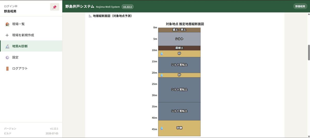
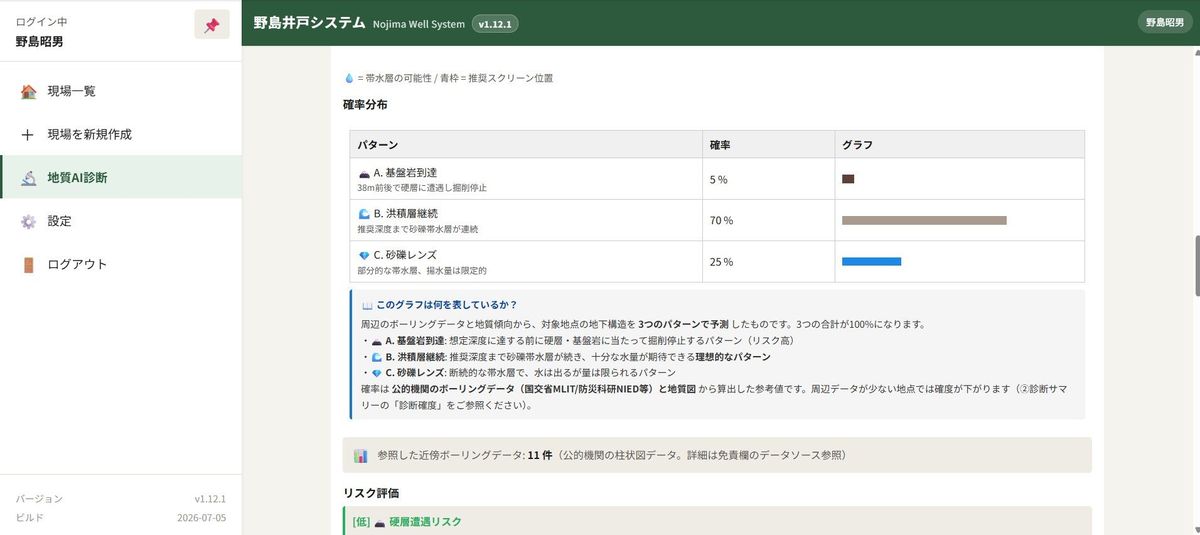
Just enter an address or GPS coordinates and AI analyzes nearby public boring data, automatically assessing strata patterns, the presence of sand-gravel lenses and the probability of an aquifer.
Combines GeoNavi (地盤情報ナビ), the national ground information search site (KuniJiban), AIST's seamless geological map and GSI elevation data for highly accurate assessments.
Besides aquifer depth, recommended drilling depth and probability of success, household reports also include water yield, water quality tendencies, estimated construction cost and recommended equipment.
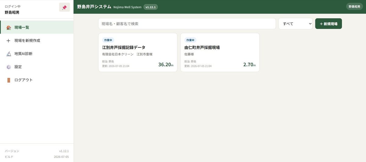
Save rod records, geology photos and geological cross-sections for each site during drilling. With PDF output and time-limited share links, they double as explanation materials for customers.
※ This feature is being prepared. If you'd like early information, please contact us.
We refer to nearby boring log data from "GeoNavi (地盤情報ナビ)," operated by Chuo Kaihatsu Corporation, to help improve assessment accuracy.
We also refer to public data from the Ministry of Land, Infrastructure, Transport and Tourism (KuniJiban) and assess the stratigraphy from multiple data sources together.
We also combine the seamless geological map of the National Institute of Advanced Industrial Science and Technology (AIST) and elevation data from the Geospatial Information Authority of Japan (GSI) for a more three-dimensional understanding of the geology.
Try it free for 14 days. You can cancel anytime during the trial and you will not be charged.
If you are considering the system, start by trying a single report. Just enter an address and see the actual output as is.AI pre-drilling well report: ¥3,000 per report (tax incl.)
※ This is a purchase of a single report, not a subscription to the system.
※ Reference information only; drilling work is not included.
It is a statistical estimate based on public boring data. The more boring data nearby, the higher the accuracy, but it is reference information for a pre-drilling survey and does not guarantee actual drilling results.
It can be used anywhere in Japan where public data exists. Data density varies by region.
We are currently coordinating with the data provider. If you would like early notice, please contact us via the inquiry form.
Yes. With the same Nojima Giken Business Hub account, you can subscribe to both Flexsys and the Nojima Well Diagnosis System.
For early trial notice or questions about adoption, feel free to contact us using the form below.